Joining Attribute Data to Boundary Data for Mapping Purposes
Frequently, a researcher has attribute data about a set of areas and wishes to map these in order to
explore spatial patterns or to carry out spatial analysis. An example might be data relating to policing
policies for a set of police beat areas.
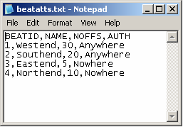
Here, we have attribute data for four police beats. We have an identifier for the beat, its name, the
number of officers assigned to the beat and the policing authority responsible for the beat.
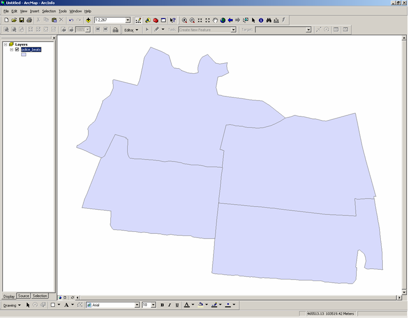
We also have a shapefile (police_beats.shp) containing the boundaries of the police beats, which we can
import into, and map within, a GIS (shown here in ArcGIS):
Various GIS packages can be used to join the attribute data to the boundary data and then map the data.
The specific methodology will depend on the package used, however the basic steps involve: importing the
attribute data into a table in the GIS; importing the boundary data into the GIS; joining the attribute
data to the boundary data based on a shared item or field.
Copyright Attribution
ArcGIS® is a registered trademark of Environmental Systems Research Institute, Inc. (ESRI). Access™,
Excel® and Notepad are registered trademarks of Microsoft Corporation. The software screen shots
shown in this page are reprinted with permission from ESRI and Microsoft Corporation. The maps shown
above are based on data provided through EDINA UKBORDERS with the support of the ESRC and JISC and uses
boundary material which is copyright of the Crown.
 Homepage