Importing MapInfo files into ArcGIS
In this example, we see how to import data from MapInfo into ArcGIS.
Data Exchange Format
ArcGIS will not read MapInfo files directly; instead, the user must create a MapInfo Interchange Format
(MIF) file in MapInfo (using Table > Export) which can then be imported into ArcGIS. MIF is a file
format which enables both graphical and tabular data from MapInfo to be imported into other software
packages. The graphic data is in a file with a .MIF extension, the tabular data is in a file with an
.MID extension, and various other pieces of information relevant to the database are contained in other
files such as .TAB, .MAP and so on. When moving or copying MIF files to other locations, the user should
ensure that they copy all of the files associated with the specified filename prefix.
ArcGIS Conversion Tool
Start ArcCatalog. From the Menu bar, select View > Toolbars. If the ArcView 8x Tools toolbar is not
ticked, select it (see diagram).
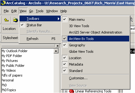
The ArcView 8x toolbar will be added to your ArcCatalog window - it will appear as "Conversion Tools".
The toolbar can be anchored along with other toolbars if you wish. It should remain activated when you
exit and start up ArcCatalog in the future so you should not need to add it again.
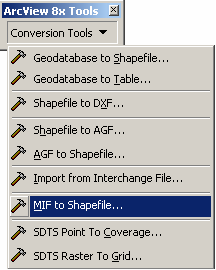
MIF to Shapefile
From the Conversion Tools drop-down menu, select the MIF to Shapefile tool.
In the dialog box which appears, browse to the MIF file that you wish to import and select it as the
Input MIF file. The dialog box should automatically recognise what type of feature class your MIF file
contains (e.g. point) and update the Feature Class field accordingly. Under Output shapefile specify the
location and name of the shapefile which you wish to create. Click OK.
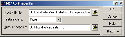
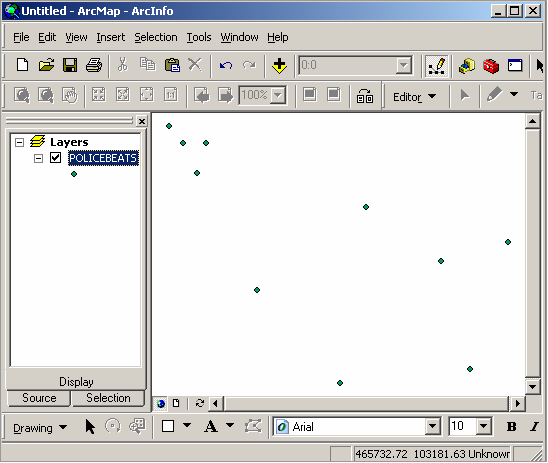
ArcGIS will convert your MIF files into a shapefile. You can now display, edit and query the shapefile in
either ArcCatalog or ArcMap
Copyright Attribution
ArcGIS®, ArcCatalog® and ArcMap® are registered trademarks of Environmental Systems Research
Institute, Inc. (ESRI) and MapInfo® is a registered trademark of Pitney Bowes MapInfo. The software
screen shots shown in this page are reprinted with permission from ESRI.
 Homepage